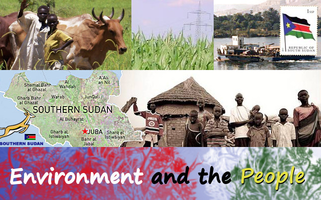
The Environment
Described as the last unexplored region in the world, South Sudan is trough-like shaped by highlands, mountains and hills at its eastern, southern and western borders.
Covering an area of just over 330,000 sq. miles (over 660,000 sq. km), or about one third the size of Western Europe, it has numerous streams, seasonal and all-season rivers flowing into the central trough from the bordering mountains, hills and from the forests of the Congo-water divide that disappear under a canopy of greenery and the expansive vegetation of the Sudd, the largest grass swamp in the world.
The Sudd breaths in and out once a year, acknowledging both the dry and the wet seasons. Breathing in, it dries up seasonal streams, contracts in rivers and her own size and leaves behind large expands of dry savannah and scattered pools far and wide. Breathing out, she swells her own chest, assisting rivers and streams to overflow their banks and flood large expands of the savannah, thus swallowing up the scattered lakes. This way it regulates and controls the livelihood of cattle herders, fishermen and wildlife alike.
Significantly, is the White Nile, which enters South Sudan at Sudan-Uganda border town of Nimule, thundering through forested hillsides, rocks and cataracts before slowing down as it approaches to the South’s main city of Juba, Central Equatoria state.
At the town of Bor, Jonglei State it branches out and practically disappears under the Sudd to re-emerge just before flowing past the provincial city of Malakal. It flows out into the open grassland and scattered woodland, across the border into Northern Sudan, where it joins the Blue Nile at Khartoum to form the River Nile that flows on to Egypt and into the Mediterranean.
In spite of the Sudd and floating vegetation, the White Nile is navigable throughout the year from Juba to Khartoum.
The People
According to the disputed census of 2008, Sudan's population reached 40.2 million. Southern Sudan was reported to have have a population of just over 8 million people. Southerners consider this to be a gross underestimation of their numbers. The most reliable census before independence in 1956 put the number of Southerners to 5 million out of 15 millions for the whole country. So Southerners have always considered their population at 1/3 of the population, the basis for the sharing of power and wealth in the comprehensive Peace Agreement, CPA, of January 2005.
South Sudan people consist of the following tribes:
Acholi, Adio (Makaraka), Aja, Anyuak (Anyuaa), Atuot (Reel), Avukaya, Azande, Bai, Baka, Balanda-Boor, Balanda-Bviri, Banda, Bari, Binga, Bongo, Didinga, Dinka (Jieng), Dongotona, Feroghe, Gollo, Ifoto, Imatong, Indri, Jiye, Jurbiel (beli), Jurchol (Luo), Kakwa, Kara, Keliku, Kuku, Lango, Larim (Boya), Logir, Lokoya, Lopit, Lotuka (Otuho), Lugbwara, Lulubo, Maban, Madi, Mananger, Mangayat, Moro, Moro Kodo, Mundari, Mundu, Murle, Ndogo, Ngulngule, Nuer (Naath), Nyangatom, Nyangwara, Pari, Pojullo, Sere, Shatt, Shilluk (chollo), Suri (kachipo), Tenet, Tid, Toposa, Uduk, Woro, Yulu